 are dependent on expensive “mother ships”—in future, they will be joined by independent marine vehicles with long-term autonomy.")
Explore in order to protect
What environmental protection measures are essential in the deep sea? Thanks to funding from the Werner Siemens Foundation, the University of Bremen was able to establish the Innovation Center for Deep-Sea Environmental Monitoring at MARUM. At the centre, researchers are developing methods to define, measure and monitor key parameters. The findings will provide the basis for environmental protection in deep-sea mining.
As a first step, the Innovation Center for Deep-Sea Environmental Monitoring will use existing measurement systems to determine what minerals and organisms actually dwell in the seabed. Hydrothermal vents in the Atlantic are the designated test sites. Then, environmental data will be collected in those areas that are likely to be targeted by deep-sea mining. It may not sound like much, but exact maps are a precondition for navigating through the darkness of the deep sea—and for finding those ecosystems that must be protected. Because standard ocean maps are charted using satellite data and measurements taken from a ship, they lack detail and precision—for instance, they often completely underestimate the height (or depth) of seamounts. To date, there are detailed maps of less than 10 percent of the deep sea. The new maps will chart the location of mountains and valleys as well as recording their height, depth and composition. This will enable researchers to draw many important conclusions about the kind of life dwelling there. Slopes of seamounts, for instance, are popular abodes for numerous types of organisms.
Map, observe, sample
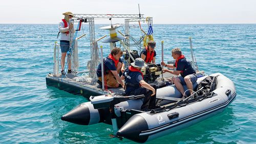
Since the start of this century, MARUM researchers have been able to send video-controlled underwater robots down 4000 metres to the seabed from a research vessel. The underwater robots chart high-precision maps and capture images of even the tiniest sea creatures, for instance crabs and beard worms. They also collect samples and can research organisms in their natural habitats—deep-sea sponges, for example, intensely dislike being brought on-board a ship. The robots are also capable of placing sensors in the deep sea, thus allowing researchers to observe a single region over a longer period of time. Researchers at the Innovation Center for Deep-Sea Environmental Monitoring will use all these technological capabilities—at the same time, they are further developing the existing systems, with the aim of creating autonomous, intelligent and mobile systems that function independent
of a “mother ship”.
 and director of the Innovation Center for Deep-Sea Environmental Monitoring Ralf Bachmayer are working to protect the deep sea—in the background: cooled drilling cores that are archived in the MARUM core shed.")
Experienced director, experienced team
Professor Ralf Bachmayer heads the centre, which is financed by the Werner Siemens Foundation. Bachmayer looks back on years of experience in the development, navigation and steering of unmanned maritime vehicles in the upper thousand metres of the ocean. The position in Bremen is what brought the researcher back home to Germany in 2017, after 23 years in the US and Canada. Ralf Bachmayer studied electrical and mechanical engineering and will work with specialists at MARUM and the University of Bremen from the fields of engineering, informatics, mathematics and visualisation. Their common goal is to master three central challenges: sensor technology, navigation and communication in the deep sea.
Navigation challenges
Navigating the abyssal deep sea without contact to a ship poses considerable challenges—there is no submarine GPS. As a rule, navigation is done with the help of sonar-based maps, acoustic signals and inertial navigation systems (INS). “These are systems that—based on acceleration and velocity—allow us to precisely determine the orientation of a vehicle and estimate the coordinates,” Ralf Bachmayer explains.
Smart sensors
Acoustic signals are also used to communicate underwater but have the disadvantage that their energy consumption per bit is significantly higher than optical systems. For their part, optical systems have the disadvantage that their data-transfer range is unable to extend to the thousands of metres required for deep-sea exploration. Ralf Bachmayer’s approach to solving the problem? “We’re making the sensors so intelligent that they can take on part of the data processing and autonomously create and then transmit an image of the environment from the data collected.”

 und sein Mitarbeiter Paul Riesen überprüfen das zusätzliche Druckgehäuse eines neuen optischen Sensors auf einem kleinen, ferngesteuerten Unterwasserfahrzeug.")
Ultra-high resolution, please
Another challenge is transmitting data from seabed to surface. In the deep sea, light becomes muted and is therefore unsuitable as a long-distance conduit for data. And electromagnetic waves (radio waves), as used on land, transfer data too slowly. What the researchers really want, however, is the best-possible resolution—which are images in 4K. But how to transfer the data accumulated? In the end, energy efficiency will be the decisive factor. “We can’t install a supercomputer with high energy consumption in the deep sea,” says Bachmayer. “And there’s no data cloud. It all has to happen locally.”
Stationary observatories
To date, the standard approach to data transmission has been to collect data in the deep sea and then analyse them on-board. For the past 10 years, stationary observatories connected to the mainland by cables have also been in use; the secured energy source of these stations provides the advantage of fast data transmission. As partner in an observatory off the west coast of North America, MARUM has installed sonars to map methane bubbles. But the stations have drawbacks. Because the sonars consume so much energy, the equipment must be connected to an outlet. Moreover, these kinds of observatories are incredibly expensive, costing up to hundreds of millions of euros. And there is a risk that, a few years down the road, it will become clear that the location of the observatory is not ideal. Moving is, however, not a viable option because of the cables.
Mobile, autonomous, intelligent
Mobile, autonomous, intelligent systems therefore seem most promising for deep-sea research, and they are also an excellent supplement to the existing stationary observatories. A mobile system is better suited to covering diverse regions of the seabed and charting large areas, all of which would aid researchers in their search for the most important ecosystems in the deep sea. Should climate change cause the water temperatures to rise or the ocean zones to shift, mobile, unmanned systems would be able to move along with them. The new technology would also make long-term observations affordable—and researchers need data collected over longer periods of time to distinguish natural fluctuations from human-induced changes. None of this is currently possible. And yet, it is more important than ever: the first mining companies are primed to begin excavating the deep sea. When they begin, at the very latest, it must be clear what protection measures will safeguard the deep sea from irreversible damage.
Text: Brigitt Blöchlinger
Photos: Margit Wild


